« Endings/Beginnings »

« Exile is an ending, but it is also a beginning. The place of exile is forever. Even a return to a specific geography is experienced as difference, for one’s starting place is altered almost beyond recognition. Yet this alteration can bring closure, a return not to a specific location but to a landscape that is before and after exile.
 
This landscape takes shape within a history, culture, and religion of a people, a people among others, and as a bridge between these. Discontinuity of time and place exist; they are formative experiences for the extension of thought and sensibility. In this space, compassion and the quest for justice deepen. Continuity, or at least the illusion of continuity, is the place of empire.
 
Community is the realization, more the experience, of discontinuity, and therefore it is the sense that only within the brokenness of life are embrace and love possible. This fracture in the structure of life is personal and communal; it drives the perpetual choice of empire or community. At the end of the day, are we not defined  by this simple choice, this direction, of journeying toward empire or journeying toward community? »
– Marc Ellis, in Iskandar, A. and  Rustom, H. (2010), Edward Said: A Legacy of Emancipation and Representation, p. 362
14726383_1800326436922730_889469280117063680_n.jpg

Re-reading Geography – Week 5

This week’s readings

  • Jay Johnson, Renee Louis, and Albertus Pramono, Introduction: Indigenous Cartographies and Counter-Mapping
  • Jay Johnson, Renee Louis, and Albertus Pramono, Facing the Future: Encouraging Critical Cartographic Literacies in Indigenous Communities
  • Bjørn Sletto, Special issue: Indigenous cartographies
  • Joe Bryan and Denis Wood, Weaponizing Maps: Indigenous Peoples and Counterinsurgency in the Americas

Johnson, Louis, and Pramono introduce us to the world of indigenous cartographies. The past two decades have witnessed the increasing expansion of formal legal and political rights to indigenous peoples in parallel with advances in cartographic technology. This has enabled many, with the assistance of cartographers and their advocates, to claim such rights at various political arenas– from international forums and United Nations conferences to the struggle to establish land claims in their native countries.

The encounter between “indigenous” and “modern” or Western cartographies has come alongside awareness of the flaws of the latter. Its tendency to fix static boundaries, emphasize quantitative metrics,  and regard the results of “scientific” inquiry as unquestionable truths silence indigenous ways of knowing,  therefore subtly legitimising the colonial condition. This risks reifying, even essentialising, the difference between indigenous and Western epistemologies. The challenge for critical cartographers is in “translating” tensions between diverse spatial knowledges and practices. Above all, this requires greater sensitivity to the uneven power relations involved in the process of mapping and map-making alongside indigenous peoples.

By way of conclusion, Johnson, et al. cite Mark Palmer, who proposes the “comingling” of indigenous and Western cartographies through indigital geographic information networks (iGIN), which far from imposing a singular “correct” way to do mapping, encourages diversity and draws on the unique strengths of both. Others have even used dreams and memory-scapes to map out ancestral domains.

In a second article, the same authors extend this line of argument in their push for the development of a critical cartographic literacy, along the lines of Freire’s pedagogy of conscientização (critical consciousness), among indigenous communities of the settler colony of Hawaii.

What struck me most was their introduction to the Hawaiian notion of “facing future”.   In this worldview, we face the horizon with our backs to the sun – that is, in full awareness of the past and all that came before us.

Their description of the corporeality of indigenous epistemology resembles the Levinasian ethic that calls on us, as beings of embodied consciousness, to turn toward the oppressed.  In this case, turning toward is an orientation toward the colonised and their descendants in the postcolony of Hawaii. It becomes an act of remembering the violence of erasure enacted by the divisions imposed between colonised/coloniser, East/West, Black/White, Indian/Settler, which renders a genuine encounter between them impossible. The legacies of erasure, the silencing of indigenous understandings of the world, are felt to this day, and demand a response of the kind that Johnson, et al. seek to make.

The rest of their paper is concerned with creating new forms of encounter between indigenous epistemologies and Western technology that can enhance, and not erase, this process of remembrance and solidarity.

programcover

In a similar way, Sletto refocuses attention from cartography as a technical process to mapping as a fundamentally political act. Here the fundamental question is “what sort of space is being mapped? Space as normatively predetermined by power, or space as an everyday, shifting and contingent product of subjectivities, lived experiences, and tangible and intangible social and material relations?” (p. 149)

If we take the second option, then this opens the way for alternative cartographies that depart from the Cartesian, statist imaginaries that otherwise define geographic boundaries as fixed and impermeable.

His discussion of a participatory mapping project among the Pemon in the Gran Sabana in Venezuela reveals the way competing narratives between indigenous peoples and state authorities were mediated by informal family networks, settlement, and seasonal migration patterns. Boundaries, regardless of the illusion of fixity superimposed on the region in official maps, turned out to be quite fluid and permeable.

Sletto concludes by emphasizing the positionality of map-makers and the political implications of the maps we produce.

Indeed this is something highlighted by Bryan and Wood, who describe the uneasy encounter between “modern” political institutions and the more ancient norms and spatial imaginaries of the First Nations (the Cree, Inuit, and Dene) of Quebec and British Columbia. Emerging from this encounter was the magisterial Inuit Land Use and Occupancy Project, which served as a blueprint for all future treaty negotiations between the Canadian government and indigenous representatives.

While indigenous peoples were allowed formal participation in laying down the boundaries of their ancestral domains, the Canadian government ultimately set the parameters within which negotiations took place. The very terms of those negotiations were mediated in the cartographic language of a distinctively Western-European epistemology.

Ultimately, the process of mapping became a way of collecting information from the First Nations and incorporating them, as citizen-subjects, into the institutional matrices of the Canadian state.


Post-hoc, Post-war, Post-life


I woke up today more depressed than I usually am. So I went rifling (as in searching, not rifle-as-in-gun) through my albums.

Found these three photos. The first is from Gaza – but it could be anywhere in the Middle East at the moment – by  Ahmed.

944012_1015683208486347_455063044919698732_n.jpg

Another is a photo I took of a girl (she seems more-than-human?) from Hebron last July.

DSC_0768.JPG

And the last two photos are shots (by a camera, not a gun – yes, it’s possible!)  I took in October of kids from Barangay Tukanalipao, Cotabato, where a bridge and irrigation works have finally been built after an influx of aid and reconstruction efforts, post-Mamasapano.

DSC_0028.JPG

DSC_0022.JPG

Proof of our government’s compassionate competence.  Like post-Yolanda, development is post-development. Post hoc, always post hoc.  After-the-fact.

“Welfare”, “development”, “economic growth”, “social services” – such miracles are heard by human beings, from Sana’a to Hebron to Kidapawan, only post-War.   And the Market licks its lips with the prospects of profiting from the spoils of men (yes men, always men) who fight each other like Chimpanzees in a system that counts progress by how many bullets it takes to steal one patch of barren earth from one another. The men who rule our world call it growth. They call it progress. Even realism. Some of us call it death.

“Because this is the way it has always been among men”, they claim.  (despite the facts) Until the earth is destroyed or no one is left to take account of the carnage.   Post-life.

Just a soft reminder that this world is bigger than our privileged Manila-centric bubbles. It’s also bigger, at once hopeful and hopeless, than the banality of Philippine politics would have you believe.

Re-reading Geography – Week 4

This week’s readings

  • Chris Perkins, Plotting practices and politics: (im)mutable narratives in OpenStreetMap
  • Craig Dalton, For fun and profit: the limits and possibilities of Google-Maps-based geoweb applications
  • Richard Rogers, Mapping and the Politics of Web Space
  • Stephane Roche, Eliane Propeck-Zimmerman, and Boris Merickskay, GeoWeb and crisis management: issues and perspectives of volunteered geographic information

Perkins draws on Latour to suggest that maps are embedded in networks or assemblages that make the transformation of meaning possible. Maps do not simply deliver fixed meanings to an audience in a linear direction. Rather, we interact with them, and their meanings in turn depend on the contexts in which we use them (i.e. “the back seat of a car, in the laboratory, in an art gallery, on a mobile screen…”). In that sense knowledge is emergent and processual.

It is in this context that he explores the potential of new technologies, enabled by Web 2.0, in reproducing neogeographic assemblages at the heart of which is “volunteered geographic information” — or crowd-sourced mapping.

While some see applications like Open Street Map (OSM) or Google Maps as heralding the emergence of collaborative cartographies that democratise the production of geographic information, others point to their limits – not least in their potential to exploit the free labour of millions of users who openly contribute information that powerful interests are free to mine for their own ends.

Perkins sees both processes at work, not least given the fact that open source mapping still depends on a “technocracy” of government regulators, private companies, and Silicon Valley experts who are the de facto gatekeepers of the internet. Similarly, Rogers explores the politics of web space; new technology allows us to see the linkages between various interest or issue coalitions in the virtual topologies (drawing again on Latour) of the internet.

Dalton, for his part, views trends in GeoWeb technology more positively.  Applications like Trendsmap    derived from a Google Maps-based platform through a policy where Google freely opened up the technology to developers. Google Inc. then had essentially limited control over the trajectory of their development. This allowed for ways to creatively hack the original software, while at the same time creating new mapmaking subjects and knowledges.

He argues that while “fun and profit” play a big role in inspiring such innovations, non-profit applications for advocacy or public service are also making headway.

Roche, et al. demonstrate the potential of geolocation software for crisis management and emergency response planning.  This was certainly the case in the weeks following typhoon Haiyan, when thousands of people spontaneously volunteered information through Twitter, Facebook, and Google Maps, allowing aid organisations and media to locate people in need of assistance. Of course, this also led to a data glut which points to the importance of having mechanisms to sift through the information overload.

GeoWeb technologies are also useful for long-term development programming and conflict resolution efforts. Global development organisations like Oxfam and USAID, for instance, have explored participatory GIS to help resolve land use disputes and aid urban and rural land use planning in Kenya, Tanzania, Mongolia, and parts of the Southern Philippines.  For informal settlers, a key concern is often security of tenure and the fact that they “aren’t on the map”[1].  GIS has also been used to pinpoint communities in most need of access to public services in depressed areas.

There are risks, however, of this reinforcing a kind of governmentality that silences healthy civic dissent, unless these technologies are part of broader efforts toward expanding public participation and truly democratising land use planning.

[1] We saw this when doing community mapping in a relocation site in North Caloocan, as part of a research project with Kristian Saguin and Andre Ortega, where neighbourhood associations complained repeatedly about their roads and homes not being visible on the satellite image we brought with us. In these cases people actually want to be “mapped” and seen, if only to secure their status as “legitimate” residents, and prevent the possibility of being evicted without notice.

Re-reading Geography – Week 3

This week’s readings

  • David Pinder, Mapping Worlds
  • Denis Wood, Maps Blossom in the Springtime of the State
  • Mark Monmonier, Maps, Votes, and Power
  • Thongchai Winichakul, The Coming of a New Geography

Winichakul takes us through the evolution of geography as a discipline in the Kingdom of Siam (Thailand today), the result of creative encounters between East and West, or as he puts it rather poetically, “the rendezvous of indigenous astrology and Western astronomy, as well as everything in the spectrum in between” (p. 46).

The actions of Siamese nobleman Thipakorawong and Mongkut’s challenge to the court astrologers of his re-enact tensions between science and religious tradition in Western Europe. Indeed they remind one of attempts by late-Medieval European scholars to reconcile new scientific understandings of the universe with their theological convictions – resulting in various forms of deism – if only to justify them to a religious public still beholden to the rigid orthodoxies of the Catholic Church.

Even more interesting is Winichakul’s focus on the transition from indigenous to “modern” understandings of space, which only underscores the fact that maps do more than represent reality. They actively shape reality by shaping the very terms by which we imagine the nation – in this case, the “geo-body of Siam”. To imagine a nation on a contemporary map is to associate a country with fixed boundaries, a state, and rules that govern the international system.

Denis Wood picks up on this theme by pointing out that by describing maps as actual representations of reality, there is a tendency to naturalize them, and therefore to obscure the social relations that necessitate the production and use of maps. Wood emphasizes that maps are a relatively recent invention bound to state power rather than originating in a ‘natural’ human tendency to put place on paper.
With the rise of new mapping technologies, and the increasing confidence with which they are being used by a growing number of people, it seems the possibility exists to subvert the mapping monopoly of the “experts”, and for both the purposes and techniques of cartography to be placed in the hands of the wider public.

Similarly, David Pinder argues that maps almost always fulfil an ideological function; that is, they function in the service of specific interests at specific times.   Deconstruction is especially useful in unpicking the truths established by maps, by reading them as texts – analysing their authorship, relationship to other texts, signs and symbols that together form their unique rhetoric.  Pinder also draws on situationist thinking, inspired in part by Debord and Lefebvre, to underscore the performativity of maps and to complicate interpretations of maps as simply tools of power (or alternatively, ‘resistance’).

Monmonier takes the case of the redistricting of New York city to illustrate the intersections between   votes, legislation, power, and cartography. This could certainly be applicable to LGU politics in the Philippines, where voting populations – determined by the jurisdictional scope of municipalities and cities – figure highly in decisions by local political dynasties and national parties during election season.

Re-reading Geography – Week 2

This week’s readings

  • John Krygier and Denis Wood, Ce n’est pas le monde
  • Morton Gulak et al., Mental Mapping in the Richmond Region: The Use of the Physical Environment in Building Regional Cooperation
  • Lewis Robinson, The varied “mental maps” our students have

Krygier and Wood offer an interesting discussion on the nature of maps through a comic book chapter. They conclude that from representing reality, in all senses of the word, maps are propositions that make claims about reality, and can only ever capture aspects of that reality. By emphasizing certain aspects of space over others (i.e. counting the number of malls as an estimate of urban economic growth at the exclusion of other possible interpretations of city space – like the informal economy of slums), maps essentially create reality, and depend significantly upon the map-maker’s purpose or starting assumptions.

A comic book is an interesting, clever way of clearly and simply outlining key debates around what maps are – one that is itself a kind of representation.

Robinson expands on our understanding of representation in an article that delves into our “mental maps” of the world. Drawing on his experiences teaching geography courses at the University of British Columbia,   Robinson tests his students’ preconceptions of what the world, within and beyond Canada’s borders, looks like.  He discovers that map-making is an act of communication, one laden by our political assumptions of how the world ought to look like.

A chapter from Ellard’s book[1] deepens this analysis of mental maps, tracing our cognitive images of borders and nation-states to our imaginaries of everyday lived space – i.e., “the cartography of our own inner mental spaces”. He traces our contemporary cartographic perspectives to the human species’ – often clumsy – attempts to render geographic space legible.

In contrast to last week’s readings which sought to connect our (“modernist”, “abstract”, “reductionist”) mapping practices to historical transformations in modernity, Ellard sees our propensity to make maps as something innate to the species – for instance, drawing on Yi Fu-Tuan to argue that our upright posture has to do with our preference for straight, vertical and horizontal lines with which we construct our maps.   This has at times made it difficult for us to accurately map out the world in all its oblique or muddled complexity.

Finally, in Gulak et al. urban planners were tasked to draw a map of the Richmond Region, Virginia in an attempt to test the “imageabilty” of roads, state boundaries, key historic sites, among other factors of apparent relevance to the individuals involved. Their work has implications for the use of mental mapping as a research methodology as well as an instrument for land use planning to improve conservation efforts, tourism, heritage site restoration, and regional economic cooperation.

[1] Colin Ellard, You are Here: Why We Can Find Our Way to the Moon But Get Lost in the Mall

Re-reading Geography- Week 1

This is the first of a series of weekly reflections on readings from our class with Dr. Joseph Palis, Cultures of Mapping and Counter-Cartographies (Geog 292). 

[Will try to do this more ofen. Since I promised myself I’d do more  »geography » with this blog =P].

This week’s readings

  • Michael Curry, Toward a Geography of a World without Maps: Lessons from Ptolemy and Postal Codes
  • Miles Ogborn, Knowledge is Power: Using Archival Research to Interpret State Formation
  • B. Harley, Maps, Knowledge, and Power

Drawing on language as an analogy for cartography, Harley contests the positivist ethos that assesses maps according to their “accuracy or inaccuracy” in the degree to which they reflect or represent the “real” world. Maps, he points out, in fact construct that world. Maps are actively political images that communicate ideological messages, often in the service of the powerful – legitimising empires, buttressing the territorial pretensions of nation-states, commodifying and enclosing common land, and asserting the supremacy of private property (or corporate) rights.  And they do so under the guise of “disinterested science”. If knowledge is a form of power, such power derives from presenting itself as value-neutral, depoliticised truth.

Maps also function by rendering invisible that which power seeks to control (or cannot control), in a form of othering that reflects right back on the humanity of the map-maker.   The “hidden silences” or unspoken political assumptions of 18th-19th century maps in particular attempted to reinforce the divide between the European self and the Barbarian, black/Asian other,  paradoxically rendering bare the West’s own barbarous colonial conquests.

Harley concludes by emphasising the extent to which cartographic discourse and imperial ideology are linked. Maps have throughout history largely been a “a tool for power not protest” (pp. 301) – at least until now.

For Ogborn, the production of geographic knowledge is vital to state formation. By studying the archival practices of states – the systematic collection of information about populations and territories – we can understand the nature of the state and its organisation of power over space. In my current work on the Bangsamoro peace process, I have attempted to trace the way contemporary discourses around resource control and population management resonate with colonial narratives and state practices in Mindanao’s past. One recognises this process of state construction, for instance, in the discursive production of ethnic groups whose populations were labelled, categorised, and somewhat arbitrarily imposed and deemed representative of specific parts of Mindanao by American colonial authorities. Today, the consolidation of a distinct Moro (indigenous-nationalist), Lumad, or Christian identity is actively used to claim rights over specific districts and municipalities to be covered under the Bangsamoro autonomous region.

Curry, on the other hand, problematizes concepts of topography, chorography, geography, and spatialiaty, which tend to muddle the distinctions between space and place. He argues that discourses of space and place only truly came to our attention with the emergence of the appropriate technologies (maps, data processing capabilities) which, while complicating things further on the scholarly front, are stimulating the production of new forms of data, and ways of interpreting them.

– CJ Chanco

Lumad as Bare Life: When violence is state policy

The most appalling thing about Mareng Winnie’s article is that it assumes that the « Lumad » are too conciliatory for collective resistance and that they can only speak by proxy. That they have no other voice apart from that lent, or forced upon them, by the « Left ».  She assumes much, then contradicts herself by saying that the lumad have their own « indigenous political structures », so they can speak for themselves. But this is precisely what many of them have been doing from the start, and they have been killed for it.

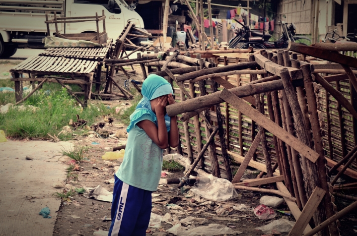
Let’s skip the empirical facts for the moment: that many of those killed in extrajudicial assassinations in the postcolony that is Mindanao have been women, children, teachers (remember Alcadev?), Catholic missionaries, journalists. That many of them were without guns. That many of the perpetrators, linked to the military and an assortment of paramilitary squads and private armies, have yet to be brought to justice. That witnesses to these killings have themselves been killed. That many of the victims lived quiet lives, neither supportive of the New Peoples Army (NPA) nor the Armed Forces of the Philippines (AFP), but caught in the cross fire. That many lived in militarised villages with no sign of the NPA, but which have been labelled NPA hot zones, because their homes stand in the way of a profitable gold mine. (Then people are summarily evicted/displaced/dispossessed, the NPA comes in to « defend » them, and this self-fulfilling cycle of violence continues.)

Again let’s skip the uncomfortable details for a moment, and dissect Monsod’s assumptions. Both arguments amount to what Veracini refers to as a kind of narrative or symbolic transfer of indigenous subjects in a distinctive process of colonial Othering.

By declaring that the Left speaks for them,  the lumad are emptied of their agency.  After all, it is presumed, the apparent silence of other lumad to cases of land grabbing and extrajudicial killings in their communities indicate that much of the noise is due solely to a coterie of leftist no-gooders, who are presumably out to manipulate their pliable hearts and minds (and ours as well)  for electoral gains.  In contrast to this she argues for the integrity of indigenous social structures, but behind this is the assumption that these are legitimate  and authentic only in so far as the lumad voice their opposition within the bounds of the nation-state’s parameters of civilised dissent. Yet in many cases the very indigeneity of indigenous leaders has been called into question; with laws  manipulated to deny their indigenous status, delegitimise their claims to ancestral domain rights, and to otherwise divide and rule.

Following Monsod’s argument to its logical conclusion, the lumad ultimately have neither the right to live, it seems, nor the right to mourn and condemn their own deaths.

This reminds one of Agamben’s description of bare life: subjects stripped of their humanity in states of exception. Nicholas De Genova defines bare life as “what remains when human existence, while yet alive, is nonetheless stripped of all the encumbrances of social location and juridical identity, and thus bereft of all of the qualifications for properly political inclusion and belonging” (De Genova 2012; for a conversation with Judith Butler’s critique of Agamben’s bare life, see podcast Bodies that Matter, Lives that Don’t: Bare Life as Horizon).

Bare life is closely related to  homo sacer (sacred man), that figure of Ancient Rome who was excluded from society, so emptied of functional meaning that their bodies were unworthy even for use as religious sacrifice, and thereby exposed to the legitimised violence of  the sovereign, which does not necessarily mean the state:

« The sovereign sphere is the sphere in which it is permitted to kill without committing homicide and without celebrating a sacrifice, and sacred life [homo sacer] — that is, life that may be killed but not sacrificed — is the life that has been captured in this sphere…The sovereign is the one with respect to whom all men are potentially homines sacri, and homo sacer is the one with respect to whom all men act as sovereigns » (Giorgio Agamben, « Homo Sacer », 2004).

One might extend that analogy to sovereign power operative in  spaces of exception, places where the sovereign violence of the nation-state, assumed to have monopoly of the use of force and assumed to embody the interests of a fetishized Nation,  trumps its own constitutional bases for legitimacy — like the constitutional provision against settling perceived threats to the Nation by murdering them out-of-court — to « protect » that Nation.    It’s worth considering that word, extra-judicial: is state-sanctioned murder ever « judicial », ethical, or constitutional? What if it comes with a court directive?

The necessity of exclusion by legitimate murder of ostensible Others denotes an inclusion of those rendered worthy of life, to police the boundaries of society or the nation-state.  One sees this life/bare life matrix operative in the violence that pervades « Mindanao », and other contexts where violence against the subaltern Other is normalised: lumad/non-Lumad, Muslim/Christian,  citizen/non-citizen, rich/poor, real estate developer/slum dweller, corporation/indigenous community, SAF/MILF, AFP/NPA.

Monsod speaks of a different military.  She’s probably right, if only for the renewed sophistication with which the rights of a few to secure their profits, as opposed to the rights of the majority to land and life, are defended.

People are labelled ‘NPA’ or ‘Terrorist’ for reasons of expediency more than accuracy. It matters little, contra Monsod, whether or not they hold a gun. These were the same threats used during martial law in the name of the Defense of the integrity of the Nation. The point is to ask who is protecting what? For whose nation and for whose cause?

And who are the pawns here, really? The rank-and-file soldiers, used by generals and local warlords in cahoots with the military’s top brass? The lumad, their bodies mobilised for the communist cause? The professors who believe multisectoral human rights fora can deal with state violence that has become so entrenched that it seeps into our hearts and minds so that we see it as normal?

It seems that all those condemning land grabs and assassinations of indigenous peoples or activists will now forever be associated with the NPA: a convenient red-tag for every individual our society seeks to dehumanise so as to justify their slaughter.

If Monsod disagrees, then I would urge her to stand with the lumad, emphatically not for, them. Because nobody else is standing with the lumad apart from the Bayan Munas of our country, all the other scattered left groups she lumps together (un-academically) into a singular Maoist Communist « Left », plus the United Nations, and the Catholic Church. And she would do well to make the links between extrajudicial killings and the mining companies in Surigao — many owned by an ex-Marcos crony — that she presumes could be financing the paramilitaries, if she’s convinced the AFP is entirely innocent.

It’s hard to presume innocence where murder is state policy.

And even if it were not, and whether or not state force was directly involved in massacres like the Capions’ or Alcadev’s, our task should not be to condemn those who condemn, but to find an explanation and a solution to this state/society of impunity and the sovereign violence it enacts, whether through armed force or benign neglect,  on the lives of Others. And the point is to see where such violence actually starts. It starts in Manila, in Malacanang, in the Philippine Stock Exchange, where the decisions to label those worthy of life and better-left-dead are made.

There is still room, here, I believe, and the responsibility, for « intellectuals » to argue for the possibility of a future where military force is no longer needed, because the deaths of the majority for the profits of a few will no longer be the Rule of Law.

Apparently such a vision is now well beyond the imagination of the likes of Monsod.

[Christopher Chanco]

Related articles

Borders in the Closet of No Other

DSC_0822

We live in a world where the only permeable wall is Wall Street,

(oozing crisis like a plague)

and the most impenetrable are the lines on a map

that decide who lives and who dies.

Tragedy becomes crisis

only when it reaches the borders

of those who can afford borders to keep

(the skeletons in the closet, or history at bay)

Crisis becomes tragedy

with the farce of delayed recognition

Or the face of Empire’s forgotten children

Come to seek refuge in their mother’s  breast

So we essentialise?

Don’t patronise

They did the same, to our “virgin” land

raped for oil, gold, slaves, timber

for Queen and motherland.

Funnelled ODA in an endless channel

Then financed ISIL.

They say come rest on the laurels

of our corporate giants

Come enter into our sacred pacts

With the blessing of your co-opted class

On one condition (and by this they mean many)

Don’t dare enter our Eden built

With your sweat and grime

– for that you must leave behind –

With your feckless progeny

and your hopeless poverty

Your filth

Your rage

Your savage Other. Yourself. Ourselves.

We.

The Other.